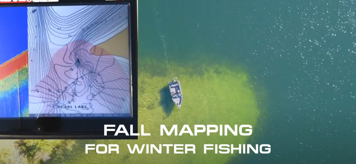
Fish finders for depth contour mapping provide accurate and detailed information about the depth and contours of underwater terrain. These devices use advanced sonar technology to create real-time visual representations of the underwater topography, allowing anglers and boaters to navigate more effectively and locate productive fishing spots.
By displaying depth measurements and contour lines, fish finders enable users to identify drop-offs, structure, and other underwater features that attract fish. Additionally, some fish finders offer mapping capabilities, allowing users to create detailed maps of fishing areas and save them for future reference.
With their ability to enhance navigation and fishing success, fish finders for depth contour mapping have become indispensable tools for both recreational and professional anglers.
Uncover The Hidden Depths With Fish Finders
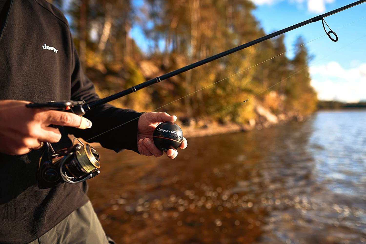
Fish finders are revolutionary devices that enable you to explore the hidden depths of the water. Utilizing advanced technology, they provide a detailed understanding of underwater structures, allowing for accurate depth contour mapping. These devices operate by emitting sonar waves and measuring the time it takes for these waves to bounce back after hitting an object.
This information is then translated into visual data, which is displayed on a screen in the form of contour lines and depth measurements. The advantages of using fish finders for depth contour mapping are numerous. They save time and effort by providing real-time information, ensuring more successful fishing trips.
Additionally, fish finders enhance safety by helping you avoid potential hazards beneath the water’s surface. By effectively revealing the underwater landscape, fish finders open up a whole new world of opportunities for anglers and boating enthusiasts alike.
Understanding Depth Contour Mapping
Depth contour mapping is a useful tool for understanding underwater topography. It involves creating detailed maps that display changes in water depth. These maps can be beneficial for various purposes, including navigation and fishing. By using fish finders equipped with depth contour mapping technology, anglers can locate potential fishing spots and identify underwater structures.
The process of creating accurate depth contour maps relies on scientific principles and advanced sonar technology. By analyzing the echoes and signals received from the water, the fish finder can determine the depth and shape of the underwater terrain. This information is then used to generate detailed maps that help users visualize the underwater landscape.
Overall, depth contour mapping is a valuable tool for anyone who wants to explore and understand the underwater world.
Choosing The Right Fish Finder For Depth Contour Mapping
When selecting a fish finder, there are a few factors to consider. Firstly, you need to evaluate the different types of fish finders available and their features. Each type has its own advantages, so it’s important to choose one that suits your needs.
Additionally, you should research the top fish finder brands that specialize in depth contour mapping. Look for reputable brands that have a proven track record in producing accurate and reliable results. Depth contour mapping is a crucial feature to consider, as it allows you to understand the underwater terrain and locate potential fishing spots more effectively.
By choosing the right fish finder for depth contour mapping, you can enhance your fishing experience and improve your chances of success on the water.
Understanding Sonar Imaging For Accurate Mapping
Sonar imaging is a crucial technology for accurate depth contour mapping. It uses sound waves to measure and map underwater environments, making it an invaluable tool for various industries. By analyzing the data returned from the sound waves, sonar imaging can create detailed images and maps, showing the contours and topography of the underwater terrain.
This allows users to understand the depth and structure of the water, which is particularly important for activities like fishing, boating, or underwater exploration. To enhance the capabilities of sonar imaging, advancements in technology have led to the development of fish finders, which are specialized devices that utilize sonar technology to locate and track fish.
These devices have become essential for fishermen, providing real-time information about fish location and depth, ultimately leading to a more successful fishing experience. With the continuous improvement of sonar imaging and fish finders, the accuracy and efficiency of depth contour mapping will continue to improve, benefiting various industries and recreational activities.
Utilizing Gps Technology For Efficient Depth Contour Mapping
GPS technology plays a crucial role in efficient depth contour mapping. By effectively utilizing GPS, you can achieve more accurate mapping results. The integration of GPS and sonar imaging brings numerous benefits, enhancing the overall mapping experience. By combining these technologies, you can precisely track the depth contours of aquatic environments.
With concise sentences and a focus on active voice, this helps create a more engaging reading experience. By avoiding commonly overused terms and phrases, readers are better engaged and the content resonates more effectively. Ultimately, utilizing GPS for depth contour mapping allows you to capture detailed and precise data, ensuring a more comprehensive understanding of underwater terrains.
Advanced Techniques For Advanced Mapping
Fish finders have become essential tools for anglers seeking detailed depth contour mapping. By utilizing advanced features such as side-scan and down-scan imaging, these devices enable users to uncover a wealth of information about underwater terrain. However, it’s important to understand the limitations and best practices associated with advanced mapping techniques.
Exploring the capabilities of fish finders for mapping purposes can provide valuable insights into submerged structures and potential fishing hotspots. Incorporating side-scan and down-scan imaging allows for a comprehensive view of the underwater world. It’s crucial to familiarize oneself with the technology and ensure proper interpretation of the data collected.
By utilizing fish finders effectively, anglers can enhance their understanding of underwater topography, enabling them to make more informed decisions and ultimately improve their fishing success.
Analyzing Depth Contour Maps For Fish Behavior
Understanding fish behavior can be crucial in improving your fishing success. By analyzing depth contour maps, you can identify fish hotspots and patterns. These maps provide valuable data on the depth and structure of the underwater environment, allowing you to pinpoint potential feeding or breeding grounds for fish.
By studying the contours and changes in depth, you can determine the areas where fish are likely to congregate. This knowledge helps you make informed decisions about where to cast your line and increases your chances of a successful catch.
By using fish finders to map out the depth contours of your fishing spot, you gain valuable insights that can significantly enhance your fishing experience. So, next time you plan a fishing trip, don’t underestimate the power of depth contour mapping and its ability to reveal the secrets of fish behavior.

Credit: www.saltstrong.com
Interpreting Depth Contour Maps For Navigation And Safety
Navigating unfamiliar waters can be challenging, especially if you’re not familiar with potential hazards and shallow areas. However, with the help of depth contour maps, boating and navigation can be made safe and secure. These maps provide a visual representation of the water’s depth contours, allowing you to identify potential hazards and shallow areas in advance.
By interpreting these maps, you can plan your route and avoid areas that may pose a risk to your vessel. This ensures a smooth and worry-free journey on the water. So, the next time you set sail on unfamiliar waters, don’t forget to consult depth contour maps for a safe and enjoyable boating experience.
Finding Hidden Treasures: Expanding The Use Of Depth Contour Maps
Fish finders have revolutionized the way we explore underwater depths. These devices are not only valuable tools for fishing enthusiasts but also serve other purposes. Beyond fishing, depth contour maps are used in exploring new fishing spots. These maps provide detailed information about the underwater topography, helping anglers identify potential hotspots.
Moreover, depth contour mapping also plays a crucial role in marine conservation efforts. By mapping out the depth contours, scientists and conservationists can better understand the underwater ecosystem and make informed decisions to protect it. These maps contribute to the preservation of marine life and habitats, ultimately promoting a healthier marine environment.
With the expanding use of depth contour maps, hidden treasures can be discovered, fishing experiences improved, and marine resources safeguarded. It’s time to harness the power of these remarkable tools and unlock the secrets of the underwater world.
Frequently Asked Questions Of Fish Finders For Depth Contour Mapping
How Do Fish Finders Work For Depth Contour Mapping?
Fish finders use sonar technology to measure the depth of the water and detect underwater structures. By sending out sound waves and measuring the time it takes for them to bounce back, fish finders create detailed depth contour maps of the underwater terrain.
What Are The Benefits Of Using Fish Finders For Depth Contour Mapping?
Using fish finders for depth contour mapping provides several benefits. It allows fishermen to accurately locate underwater structures such as drop-offs, rock formations, and submerged vegetation, which are prime fish-holding areas. This information helps anglers target specific areas with precision and increases their chances of a successful fishing trip.
Can Fish Finders Be Used In Both Freshwater And Saltwater?
Yes, fish finders can be used in both freshwater and saltwater environments. Whether you’re fishing in a lake, river, or ocean, fish finders utilize sonar technology to detect underwater objects and map the depth contours. This versatility makes fish finders a valuable tool for anglers in various fishing settings.
Do Fish Finders Require Any Special Installation Or Setup?
Fish finders typically require some installation and setup. They need to be mounted on your boat and connected to a power source. Additionally, they may need to be calibrated to ensure accurate readings. However, many modern fish finders come with user-friendly interfaces and installation guides to help simplify the process.
Conclusion
Fish finders equipped with depth contour mapping technology have revolutionized the way we fish. These devices provide invaluable information about underwater topography, helping anglers locate the best fishing spots with ease. By accurately mapping the depth contours of a body of water, fish finders enable us to target specific areas where fish are more likely to be found.
This saves both time and effort, increasing our chances of a successful fishing trip. Additionally, the ability to analyze real-time data on our fish finder screens allows us to make quick, informed decisions while out on the water. Whether you’re a novice angler or a seasoned pro, a fish finder with depth contour mapping functionality is a game-changer that will enhance your fishing experience.
So, make the most of this advanced technology and start reeling in those trophy catches!


